If you live in a big North American city—the kind of cities I’m familiar with—the average ground is asphalt and concrete, and water table is not a household term. If on the other hand you rely on a well, or a smaller town water processing plant, or you grow things at some scale, water table is a big deal. You know the term whether or not you understand it beyond the basic idea of either abundant water or water shortage, and drought.
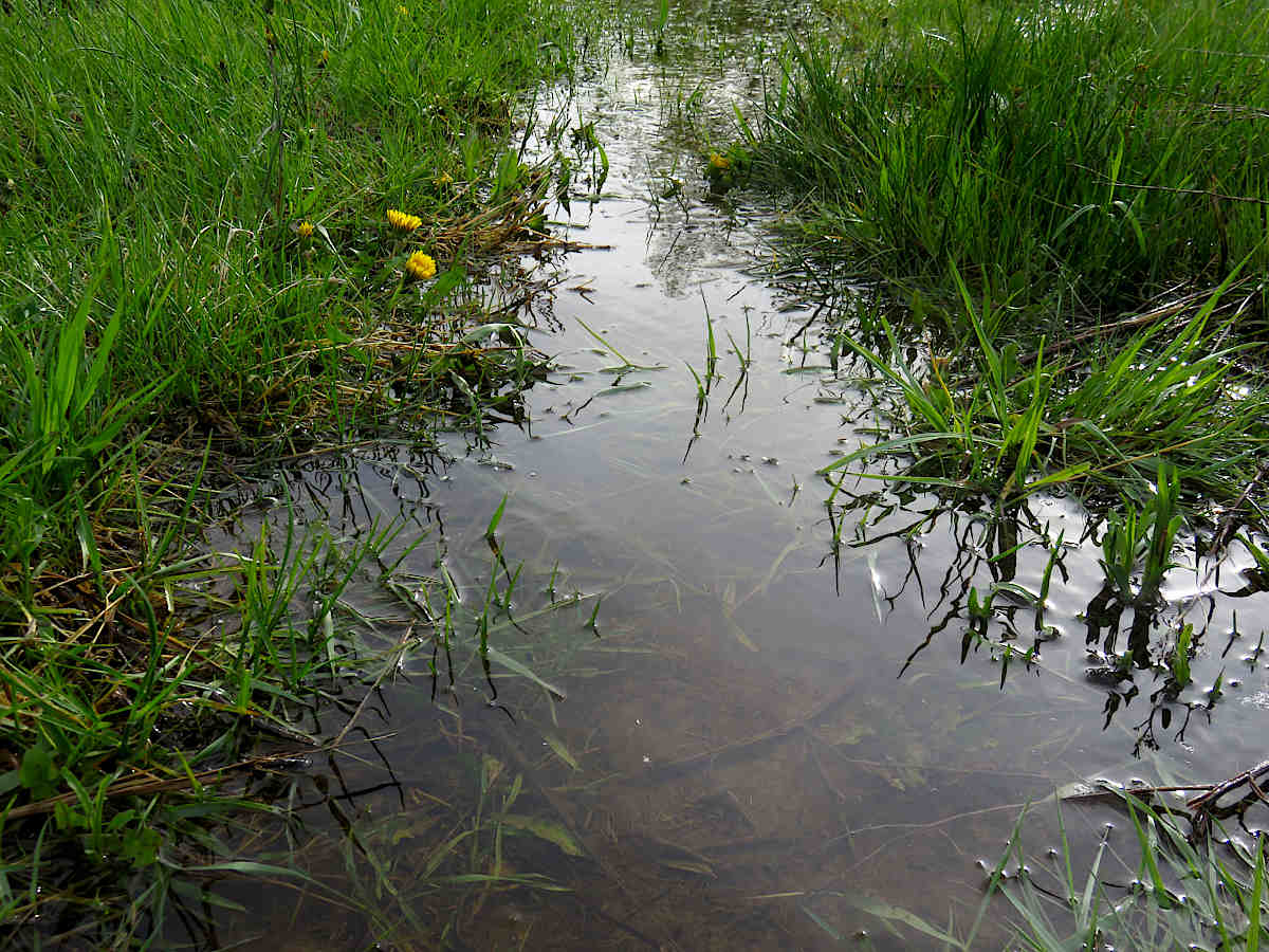
The puddle zone in the photo, in a particularly low-lying area of the field that my path to the veg garden cuts through, is my own local water table indicator. Earlier in spring, with snow melt-off and the ground still frozen quite far down, it starts out as a shallow pond, to be sloshed through in rubber boots. As the ground unfreezes and the water seeps off, down goes the puddle pond, until it disappears leaving dry ground. This is the water table level, like an underground lake or ocean that’s everywhere, except unlike when it breaks out in an open lake, here the water is running through soil. The lower the table gets, the drier the ground and the less water there is around. When you see a river dramatically drop in a droughty summer, that’s the water table, going down!
This year, the puddle has been dry for a couple of weeks, but after nearly two inches (5 cm) of recent rain, it’s back! Nearly a whole day later, it’s still pretty big, which means, lots of water right at the surface. At this point in the year, its main meaning to me is that lower spots in the field will still get a little flooded, so don’t plant there for a bit! Later on, since there’s no open water near the garden field, if we haven’t had rain for a long while, I’ll start checking the level in the dug well—lower down the string!